Throws Map (PolyField)
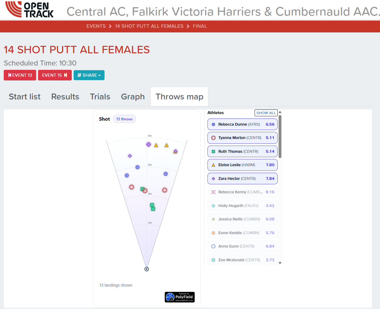
The Throws map tab draws every throw on the sector, using the landing position measured by PolyField's equipment for each attempt. It gives athletes, coaches and spectators a visual picture of where the throws landed, rather than a list of distances.
PolyField equipment is required
The map is drawn from coordinates measured by PolyField's sector measuring equipment. If PolyField is not measuring the event, the tab does not appear at all — there is nothing to plot. OpenTrack does not derive landing positions from distances.
Where to find it
Open the results page for a throws event (Discus, Hammer, Javelin, Shot Put) — the same page with the Results, Trials and Graph tabs. A Throws map tab appears beside them once at least one attempt has a measured landing position.
The tab is deliberately hidden until there is data, so throw events recorded by hand look exactly as they always have.
Reading the map
- Each attempt is a marker inside the sector, placed where it landed. Markers take the colour and shape of the athlete's silk, matching the key shown in the list beside the map.
- Ring markings are labelled in metres from the throwing circle.
- Fouls (attempts recorded as
X) are shown as crosses beside the throwing circle. Passes are not plotted. - The line under the map summarises how many landings and fouls are shown. Attempts without measured coordinates are counted in Results and on the Trials tab, but cannot be plotted.
Filtering by athlete
The panel to the right of the map lists every athlete in the event with their silk and best mark.
- Click an athlete to show only their throws.
- Click further athletes to add them to the selection.
- Click Show all to go back to the whole field.
Selection survives live updates, so you can follow one athlete while the rest of the competition is still being recorded.
Live updates
The map redraws as attempts are recorded, so it follows the competition without refreshing the page. It only redraws while the tab is open.
Data and API
Each attempt's landing position is stored on the unit's trial as polyfield.rx and polyfield.ry, in metres, exactly as the PolyField client supplied them. The sector used for the plot comes from the unit's polyfield_config (for example Hammer), falling back to the event code.
Clients can send these coordinates with a single attempt; see Units API — Add or edit a single attempt.